Webb Coastal Research Station
Overview
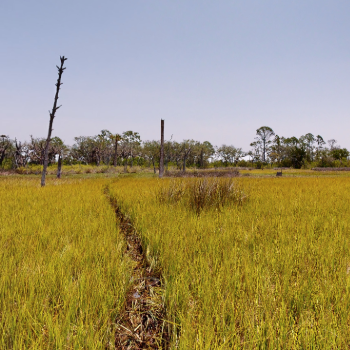
The Webb Coastal Research Station, on property donated to UNF in 2017, encompasses an area of salt marsh situated along the eastern side of the Intracoastal Waterway south of Beach Boulevard. It is used by UNF faculty and students to perform extensive research and ongoing monitoring of the salt marsh ecosystem. Below is an aerial video and a 3D interactive tour of the project, which was created to give visitors an immersive tour of the site. Please be advised the aerial video and the 3D tour do not contain audio.
The Research Technology Services (RTS) staff worked with project facilitators to provide detailed aerial imagery using different technologies to aid in the visualization of the changes over time.
Persons with disabilities who need additional assistance with the interactive portions of this page, please contact Research Technology Services staff at rts@unf.edu.
Aerial Videography
Text Transcript for Video
-
Webb Coastal Research Stations Video
The video above was captured from a Skydio2+ drone flying over Butler Island just north of Butler Boulevard at the intracoastal waterway in Jacksonville, Florida. The drone flew just over the tree tops coming from the northeast and flying toward the southwest. In the video, an eagle’s nest can be seen in the tree tops as it approaches the UNF faculty and students working in the marsh.
3D Virtual Tour
Press Play to interact with Butler Island Virtual TourText Transcript for 3D Tour
-
Webb Coastal Research Stations 3D Virtual Tour
The virtual tour above allows visitors the ability to virtually walk around Butler Island. Visitors can follow the path and see faculty and students installing elevation monitoring plots that will be used to monitor sea level rise in the marshland. The virtual tour allows visitors to explore the WEBB Property without further impacts on the marsh.
Support Provided by RTS Staff
-
Advanced Photography Techniques
The Research Technology Services (RTS) staff has been supporting researchers in acquiring data to help in the salt marsh research and monitoring. Leveraging advanced technologies, RTS staff employed drones to capture orthorectified imagery and aerial videos across various segments of the Webb property. RTS staff also utilized high-precision Global Positioning Systems (GPS) to collect topographic data and an accurate mapping of a sampling of locations, monitoring equipment, and surface elevation tables.
Orthorectified aerial imagery is a type of aerial photo that has been corrected to fix any distortions, like uneven land or camera angles. This makes the images accurate for measuring and mapping as if you're looking at a flat map, which helps in planning and analyzing areas.
-
Application of Imagery
RTS staff are actively engaged with researchers in planning the capture of aerial imagery for the entire Webb property throughout the year. This comprehensive approach encompasses the acquisition of true-color orthorectified imagery, multispectral imaging to monitor vegetation health, and LiDAR technology for precise elevation mapping.
LiDAR technology uses laser light to measure distances by hitting targets with laser beams and measuring how long it takes for the light to return. This data is used to create precise, three-dimensional information about the shape and surface characteristics of an area.
-
Establishing a Geodatabase
The RTS team is working towards establishing a Geodatabase infrastructure to effectively manage the spatial data and imagery compiled from the Webb Property ensuring accessibility to all researchers involved.